
Subscribe to Spatial Insights to receive the latest news from DCS Spatial Services.
Items of recent interest are listed below, in reverse cronological order.
News articles are considered current and relevant at the time of their publication, but it's important to note that their accuracy and relevance may change over time. If you have any questions or feedback on a particular topic please contact us.
 |
Spatial Insights latest news from DCS Spatial ServicesKeep up to date with all the latest news from DCS Spatial Services. April 2026 |
 |
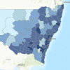
2025 DCS Spatial Services annual products survey reportResults from our 2025 survey on DCS Spatial Services products. December 2025 |
 |
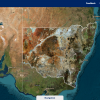
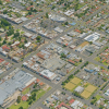
Catalogue: NSW Spatial Digital TwinThis catalogue showcases how the NSW Spatial Digital Twin unlocks powerful new ways to visualise and interact with spatial data. October 2025 |
 |
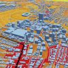
Discover the benefits of SDT Explorer, the new platform replacing SIX MapsEmbrace the future: Discover how SDT Explorer enhances spatial visualisation beyond SIX Maps. April 2025 |
 |
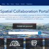
2024 Spatial Collaboration Portal Survey reportResults from our 2024 customer survey on the Spatial Collaboration Portal. December 2024 |
 |
History of the NSW Spatial CadastreExploring the development of NSW Spatial Cadastre and DCS Spatial Services commitment to its accuracy and improvement. September 2024 |
 |
Survey results on the Spatial Collaboration PortalSeptember survey results. February 2024 |
 |
How Geoscape datasets are being used by NSW Government agenciesNSW Government agencies have used Geoscape data to create initiatives to support site identification and assessment for development and planning purposes to better support people and businesses across the State. October 2023 |
 |
Partnership enhancing whole-of-government location-based reportingDCS Spatial Services is partnering with FrontierSI in a project to reduce the costs, risks and issues associated with location-based reporting. June 2023 |
 |
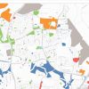
Department of Customer Service (DCS) Spatial Services mapping electoral boundaries for Government within NSWDCS Spatial Services supported the NSW Electoral Commission as part of the recent election by mapping adjustments to boundaries for each State Electoral District (SED). June 2023 |
 |
DCS Spatial Services secures new Geoscape datasets for whole-of-government accessDCS Spatial Services has secured access and distribution for two new Geoscape datasets: building footprint and trees coverage. October 2022 |
 |
DCS Spatial Services enables next step in digitisation for NSW Planning PortalDigitisation of subdivision and strata related land developments will transform how applicants and assessing authorities visualise applications via the Planning Portal September 2022 |
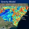 |
New Gravity Model to transform data for NSWMore accurate data to help deliver investment opportunities, aid regional jobs and drive economic growth across the State will soon be available for people across NSW with the NSW Government’s state-wide Gravity Model. June 2022 |
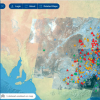 |
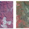
Spatial Digital Twin includes current NSW mouse plague dataDCS Spatial Services has been working with NSW Department of Primary Industries (DPI) and CSIRO’s Data61 to bring new and very current mouse plague data into the NSW Spatial Digital Twin (SDT). August 2021 |
 |
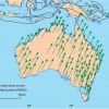
Survey team upgrades CORS site at IvanhoeDCS Spatial Services has been engaged to upgrade all of the original AuSCOPE Tier 2 CORS sites across NSW for Geoscience Australia which will contribute to the Federal Government’s Positioning Australia program. May 2021 |
 |
Elevation and depth data reaches new heightsDCS Spatial Services has collaborated with Geoscience Australia from 2017 onwards to deliver NSW elevation and depth data through the online ELVIS platform. December 2020 |
 |
New e-Planning service powered by government dataThe NSW Government has announced a new ePlanning service, delivered by NSW technology start-up Giraffe, that allows users to display and analyse the many layers of data that contribute to the infrastructure future of NSW. November 2020 |
 |
NSW Point and Service Point use Geoscape API technology to leverage better customer servicesDCS Spatial Services has been working with Geoscape (formerly PSMA Australia) on a case study demonstrating how we use their Predictive and Address API (application programming interface) products within NSW Point and Service Point. October 2020 |
 |
Digital survey plans now available to industryLand surveyors in NSW are set to benefit from access to digital survey plans captured through an innovative Australian first DCS Spatial Services project. August 2020 |
 |
NSW Survey Marks Mobile AppThe updated DCS Spatial Services NSW Survey Marks App has now been released. July 2020 |
 |
SPOT6/7 ImagerySpatial Services is delighted to announce the release of the second SPOT 6/7 imagery mosaic. July 2020 |
 |
GDA2020 Foundation Spatial Data is available via the Spatial Collaboration Portal from 1 July 2020GDA2020 Foundation Spatial Data June 2020 |
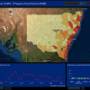 |
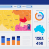
Spatial dashboarding NSW’s Small Business COVID-19 Support Grant applicationsSpatial Services is delivering real-time location-based reporting that tracks customer transactions, including Small Business COVID-19 Support Grant applications June 2020 |
 |
Notice for existing Incremental Feed clientsIncremental Feed and GDA2020 May 2020 |
 |
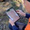
Spatial Services aids bushfire recovery efforts on many frontsHelping rebuild after the 2019/20 bushfires with spatial data. May 2020 |
 |
NSW Spatial Collaboration Portal now delivers authoritative land values and property informationThis new platform will provide access to a wider variety of spatial information than was available on the former NSW Globe. April 2020 |
 |
Discover Spatial Services’ critical role in emergency managementBehind the scenes of a crisis there’s a team that supports emergency prevention, preparedness, response and recovery in ways you mightn’t expect. February 2020 |