
CORSnet-NSW is a network of Global Navigation Satellite System (GNSS) Continuously Operating Reference Stations (CORS) covering the state of NSW and providing centimetre-level real-time positioning. The network allows nearby equipment and machinery to accurately determine coordinates for positioning and guidance solutions across a variety of sectors, such as:
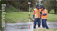
- Surveying
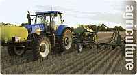
- Agriculture
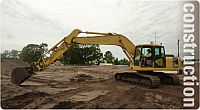
- Construction
- Emergency services
- Mining
- Scientific research
- Asset management
For more details, download the CORSnet-NSW information sheet (PDF 539.2 KB).
CORSnet-NSW real-time data is available in both GDA94 and GDA2020. See the CORSnet-NSW user guide (PDF 2.3 MB) for more information.
How does it work?
The service is delivered by a network of permanent GNSS receivers, known as Continuously Operating Reference Stations (CORS), that are strategically located across NSW.
The CORSnet-NSW network continuously observes and corrects satellite navigation signals in order to achieve international-standard, high-accuracy positioning data for NSW (JPG 470.9 KB).
The data is streamed to users via a wireless internet connection. CORSnet-NSW supports both GDA2020 and GDA94 positioning services.
CORSnet-NSW and Precision Agriculture video (click image below).
Application quick links
How to access CORSnet-NSWAuthorised reseller listing and subscription types |
Network informationNetwork coverage map plus CORS details, coordinates and more |
CORS health statusLive update of CORS health status |
Web portalSee your active subscriptions, usage history and access RINEX data |
RSS feedMonitor Information, Warning and Alert messages |
GNSS publicationsCORS and GNSS publications |
FAQsCORSnet-NSW users frequently asked questions |
User guidesGuides to help you to get the most out of CORSnet-NSW |
Useful linksUseful websites and supplementary material |
Contact usCORSnet-NSW Customer Support Helpdesk |