July 2020
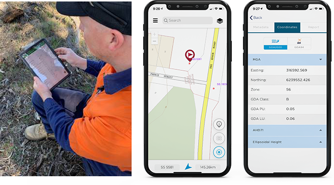
The updated DCS Spatial Services NSW Survey Marks App has now been released. The updated app, which is mainly for use by surveyors, provides customers with survey mark information on the go - in the office, on a building site or even in rural areas.
New functionality allows customers to toggle between GDA94 and GDA2020 datums – allowing you to work in the datum that suits you.
The Survey Marks App allows surveyors to:
- Search and/or view the location of survey marks against various NSW base maps and imagery
- View the published coordinate values of survey marks, including metadata such as accuracy and status
- View and download the locality sketch plan of a survey mark
- Report the status of the mark, such as found intact, not found, damaged, destroyed etc. and attach photos as evidence to the report
The NSW Survey Marks App is delivered on a new, updated platform. Customers can be assured of ongoing app updates to ensure that the app maintains compatibility with new hardware and software technology.
The NSW Survey Mark App is available on both iOS and Android platforms. For more information, see https://six.nsw.gov.au/content/mobile