Customer: Tweed Shire Council
Overview
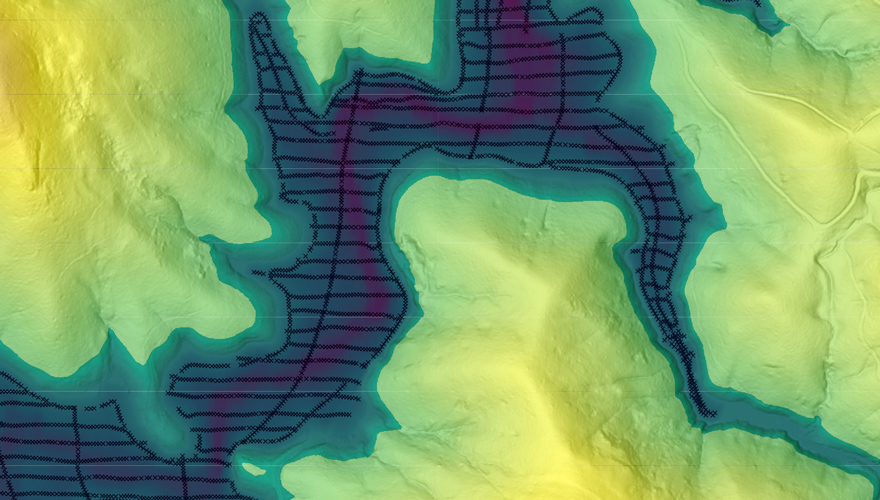
LiDAR was chosen for the project as it can penetrate thick vegetation canopy that is present in the catchment area.
Customer challenges
Tweed Shire Council recently decided to acquire new LiDAR data and concurrent imagery for the Clarrie Hall Dam, the primary water supply storage for the Tweed Local Government Area. The need for LiDAR capture was instigated in response to the negative effects of the 2022 major flood event on water quality and sediment load as well as the need for planning to raise the dam wall to increase capacity to provide a secure water supply until at least 2065.
To gain a better understanding of the landscape changes experienced during the floods, Tweed Shire Council needed to identify erosion, sediment disposition and exposed embankments. Additionally, the proposed raising of the dam wall increased the need to capture current data for the 5919 ha catchment area for analysis such as flood and flow modelling.
Tweed Shire Council required the LiDAR (and concurrent imagery) to be captured by 4 December 2022. This was seen as a major challenge due to the current demand for LiDAR and Imagery services, limited days for good weather opportunities and time availability constraints nearing the end of the calendar year.
Partner solution
To overcome the challenges of a short delivery timeframe, Tweed Shire Council made the decision to prepare a scope of services and engage Spatial Services’ Remote Sensing Services and Equipment (ReSSE) Prequalification Scheme. The ReSSE team managed the Request for Quote process on behalf of Tweed Shire Council. Having received several quotes from prequalified suppliers on the Scheme, an evaluation was undertaken prior to contract award. The vendor provided consistent communication throughout the capture phase with DCS Spatial Services and Tweed Shire Council undertaking quality assurance (QA) shortly afterward. Given the short time frame and high demand for LiDAR and Imagery services, having the capture and QA completed before the end of 2022 was an amazing result for all involved.
Customer benefits
The elevation datasets and concurrent imagery is currently being used for a multitude of purposes including the preparation of the Environmental Impact Statement for capacity increase/raising of dam spillway as well as water quality, catchment management, planning and design. The acquired data is also being utilised in many applications such as flood modelling software, computer aided design (CAD) and Geographic Information Systems (GIS).
A temporal analysis has been undertaken by Tweed Shire Council’s GIS team whereby the new LiDAR data was compared to pre-flood LiDAR data. High resolution Digital Elevation Models (DEM) were created for pre and post flood event and a ‘raster subtraction’ analysis undertaken to quantify the changes to the topography due to the flood event. Furthermore, an interactive map has been created whereby the user can observe flood event damage with a ‘before and after’ functionality.
The new elevation and feature dataset will serve as the current ‘baseline’ for all dam catchment analysis, planning and design purposes. Future plans include exploring the near infrared imagery band and how it might be able to be utilised in analysis such as vegetation as well as further temporal analysis given the dam will be raised.
“The LiDAR and imagery deliverables have been invaluable to council for analysing the effects of the 2022 flood event and for the proposal to raise Clarrie Hall Dam. Spatial Services professionalism, and in-house knowledge on imagery, remote sensing, contract preparation and administration was invaluable for this project. Moreover, there is much value in their ‘whole of government’ approach to imagery and remotely sensed data procurement – saving duplication of effort, cost and benefit to the broader community.”GIS Analyst – Tweed Shire Council
You can download the case study here.