Customer: Crown Lands
Overview
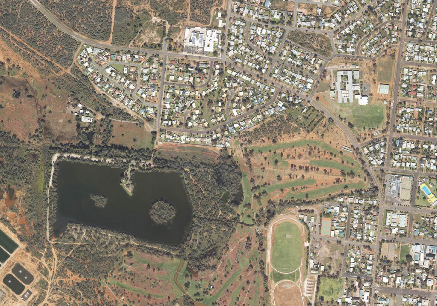
Imagery captures assist in identifying approximately 94 new Asset Protection Zones on Crown land within vulnerable NSW communities.
Customer challenges
From 2020 to 2023, the far-west and north-west areas of NSW received significant above average rainfall, resulting in prolific vegetation growth, which in some areas has not been seen for decades. Once the vegetation dries, the increase in fuel load will result in a very busy, prolonged fire season for these regions of NSW.
Crown Lands needed to build a Bushfire Mitigation Program in these far-west and north-west areas of NSW, to mitigate bushfire hazards on Crown land. Given the large number of towns and villages included in the program (approximately 28), the only way to efficiently assess these towns and villages was by a desktop assessment. The desktop assessment required high resolution aerial imagery of each town and village to undertake an accurate assessment of fuel loads and existing mitigation activities within the landscape. Some of the imagery that was available for these areas was over 15 years old and taken during a time of below average rainfall or drought, and did not meet quality requirements.
Partner solution
The solution was to capture new 10 cm imagery of all towns and villages involved in the program to support an accurate desktop assessment. The imagery would allow Crown Lands to assess fuel loads and identify existing mitigation works in the landscape and most importantly identify new treatment areas.
Crown Lands required the imagery within a short timeframe and prior to the onset of the 2022/23 NSW Fire Season, to allow for mitigation works to be undertaken on the ground. At the time, DCS Spatial Services were in the process of having new equipment installed in their aircraft. It was determined that there would be insufficient time to trouble shoot and test the new equipment in order to undertake the required imagery capture and meet timeline demands of the project.
DCS Spatial Services were able to provide an alternate solution to procure imagery through the in-house managed Remote Sensing Services and Equipment (ReSSE) Prequalification Scheme. The ReSSE team were able to assist in the development of a detailed scope of services and manage the request for quote process where prequalified suppliers from the private sector were invited to tender. Following the tender response evaluation, a contract was awarded to the successful supplier. Unfortunately, due to ongoing wet weather conditions and other unforeseen circumstances the imagery capture was delayed impacting project schedule. During this time, the DCS Spatial Services sensor upgrade was nearing completion and a decision was made to separate the deliverables, allowing DCS Spatial Services to capture far-west NSW and the supplier to capture the remaining sites to ensure the project was delivered on time.
Customer benefits
DCS Spatial Services provided expert knowledge and undertook quality assurance of the imagery, ensuring it was supplied to Crown Lands in a timely manner. DCS Spatial Services also assisted in finding solutions to store and host the data for the Crown Lands team to use.
“The new high-quality imagery allowed Crown Lands to identify approximately 94 new Asset Protection Zones within vulnerable communities in the far-west and north-west areas of NSW. The imagery is currently being used to identify further bushfire mitigation measures to protect these remote communities from wildfire prior to the 2023/24 bushfire season and will continue to be used across other areas of Crown Lands business to assist with delivery of services, leases and license, reserve management, compliance and future works.”Crown Lands – State Bush Fire Coordinator
You can download the case study here.