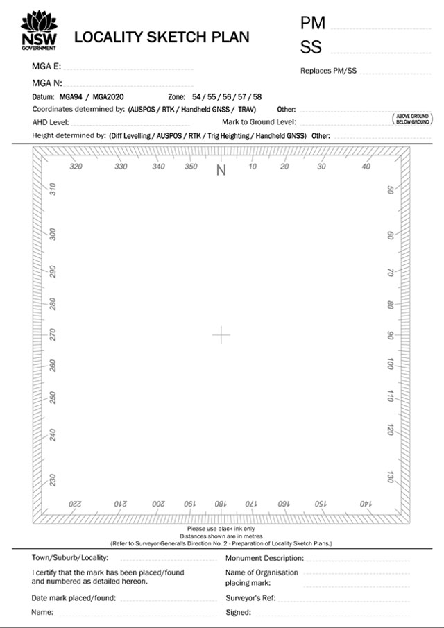
The Surveying and Spatial Information Regulation 2017 Clauses 39 and 43 require a surveyor to report the position of Permanent Survey Marks. To assist in this, a Locality Sketch Plan (LSP) form has been created to note all of the details required.
Lodgement of Locality Sketch Plans is via our Customer Hub:
- TIFF file format
- Black and white (1-bit colour depth)
- CCITT T.6 (Group 4) compression
- 200 dots per inch (dpi) resolution
- Single-page TIFFs only (only one LSP per TIFF)
- File name AAnnnnnnn.tif where AA is the mark type (PM, SS, etc.) and nnnnnnn is the seven-digit mark number including leading zeroes. For instance, PM0123456.tif is the LSP for permanent survey mark PM123456.
For further details on the preparation and lodgement of Locality Sketch Plans, please refer to Surveyor-General’s Direction No. 2 – Preparation of Locality Sketch Plans (PDF 1.3 MB).
Locality sketch plan forms are available for download in the following formats: