- Download and install MapInfo
- Retrieve the WMS URL for the service you want to use from it's REST endpoint.
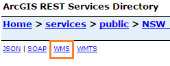
e.g. Visit NSW Imagery REST Endpoint
Look for the WMS link towards the top left of the page. Right click + copy link address, or left click the link to open the link and copy the URL from the address bar.
e.g. for the NSW Base Map service, WMS URL retrieved from the REST endpoint is:
https://maps.six.nsw.gov.au/arcgis/services/public/NSW_Base_Map/MapServer/WMSServer?request=GetCapabilities&service=WMS
Before using in MapInfo you must remove the query string component (section after the ‘?’) from the URL:
https://maps.six.nsw.gov.au/arcgis/services/public/NSW_Base_Map/MapServer/WMSServer?
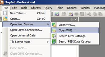
- In MapInfo, select File > Open Web Service > Open WMS...
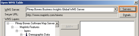
- From the dialog, select the 'Servers' button in the top right.
- In the Server List dialog, click the 'Add' button.
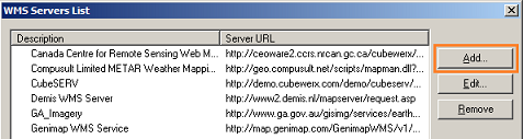
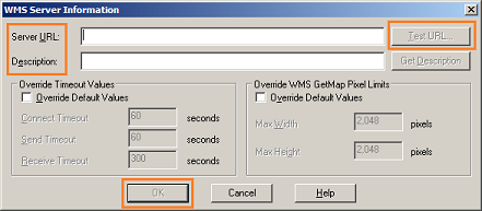
- Enter a description and the appropriate URL. Use the 'Test URL' button to test the connection, once connection confirmed click 'OK'.
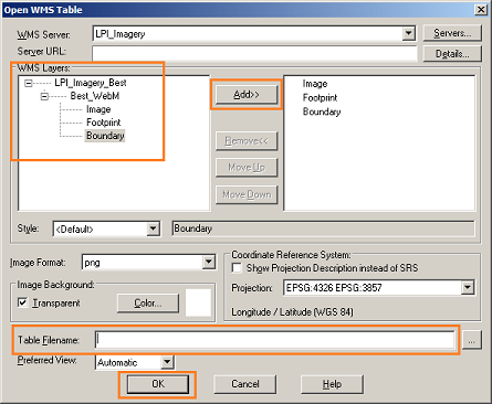
- You should now see the service layers listed in the left pane of the dialog. Click to highlight the layers you require, then click 'Add'.
If necessary update the directory and file name towards the bottom of the dialog, then click 'OK'.
Resources
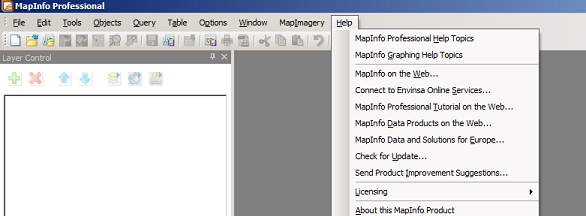
For assistance using MapInfo, visit the Help Topics and Tutorials from the Help menu in the toolbar or use the User Guides for various versions of MapInfo.